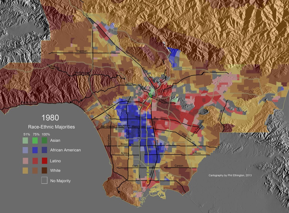
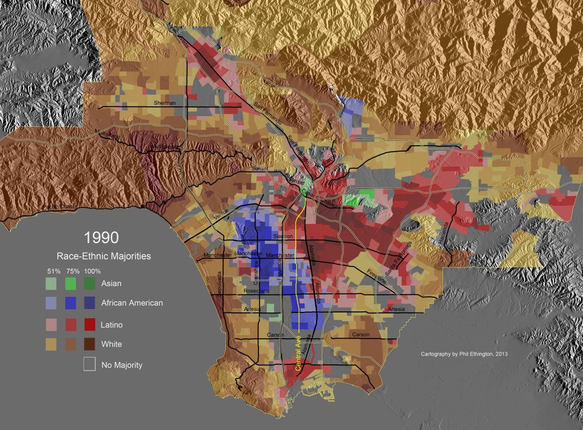
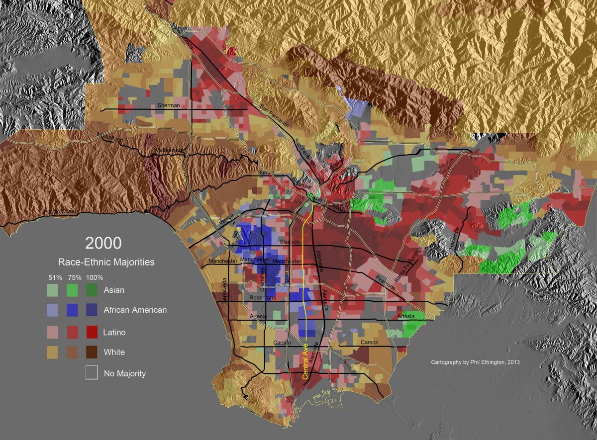
thumbnail of GM_MajorityMaps_1940-2k_20150719_Central_1980.jpg
GM_MajorityMaps_1940-... jpg
(307.25 KB, 1200x885)
thumbnail of GM_MajorityMaps_1940-2k_20150719_Central_1990.jpg
GM_MajorityMaps_1940-... jpg
(310.55 KB, 1200x885)
thumbnail of GM_MajorityMaps_1940-2k_20150719_Central_2000.jpg
GM_MajorityMaps_1940-... jpg
(314.89 KB, 1200x885)
Picrels show the changes in ethnical composition of LA. Well at least the majorities of the areas.