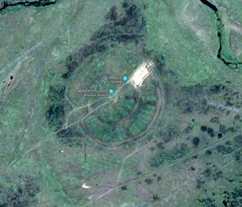
Arkaim png
(1.16 MB, 935x797)
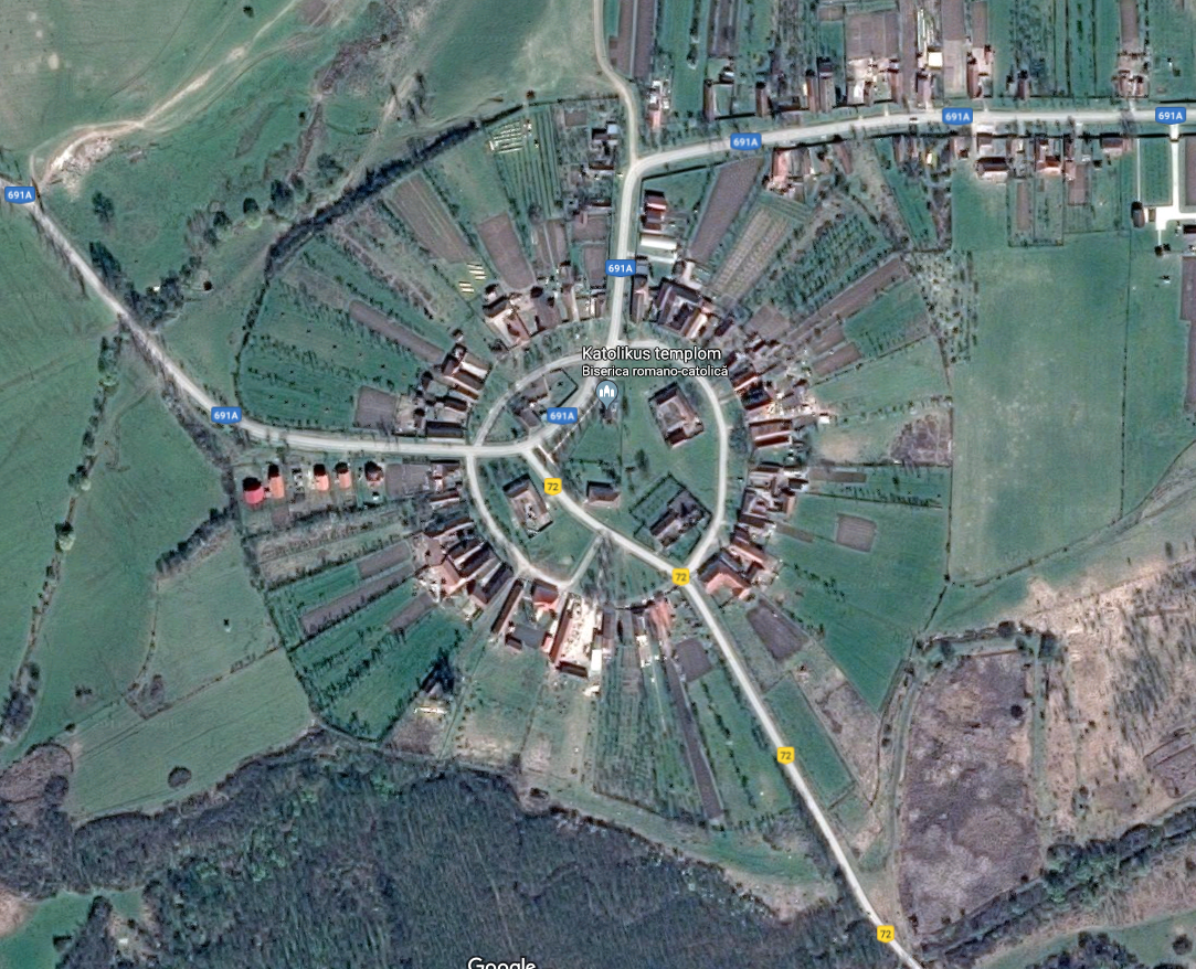
Charlottenburg png
(1.69 MB, 1083x878)
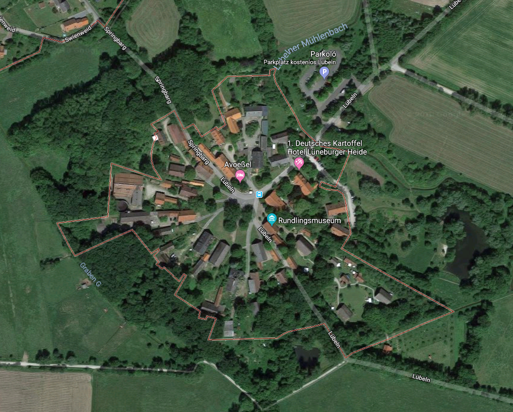
Lübeln png
(1.48 MB, 1018x817)
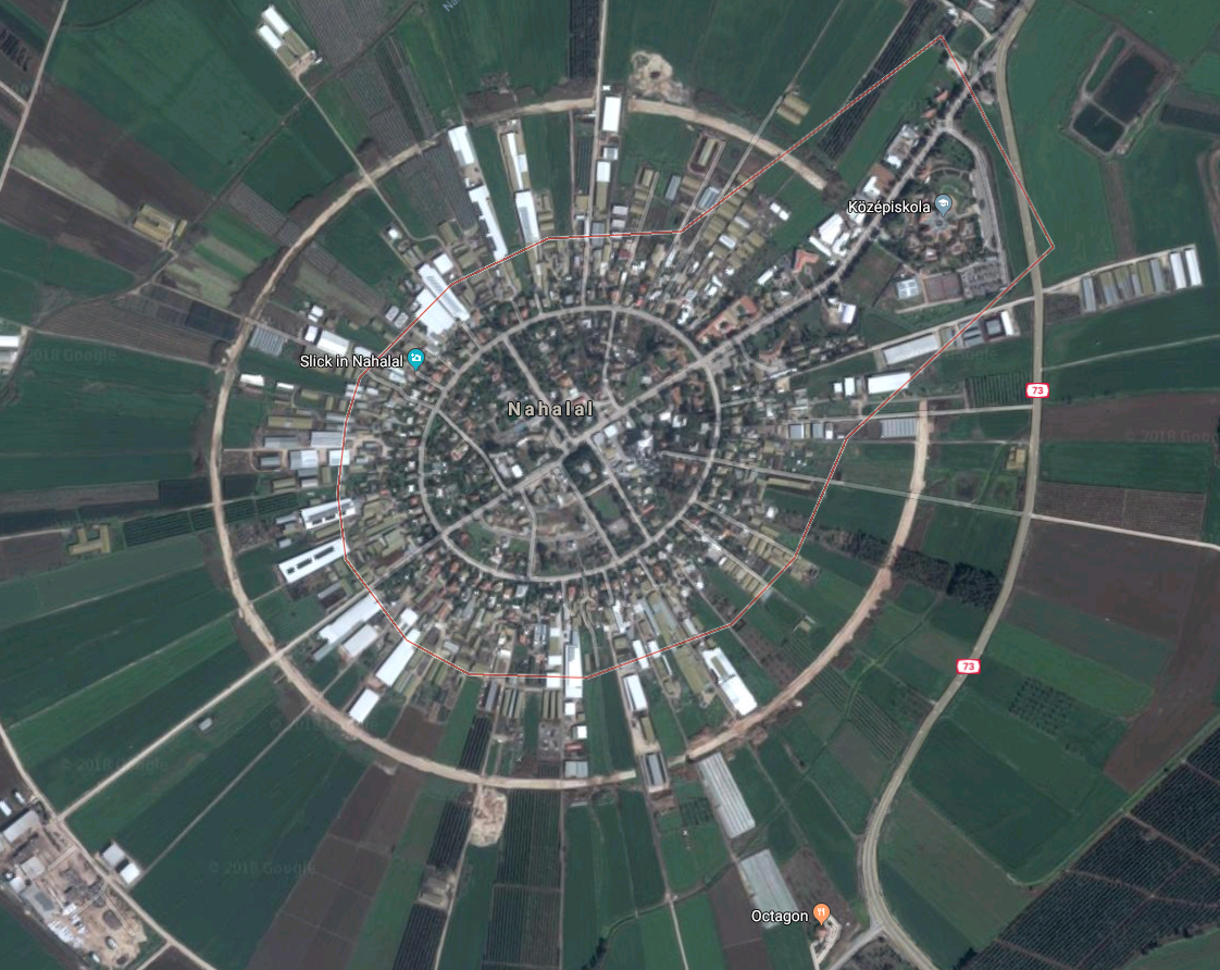
Nahalal png
(1.38 MB, 1122x892)
One of the planned layout settlement types is the round settlement. Can be found all around the world, great for defensive purposes - to some extent. In north, north-eastern Germany, in Wendland they were very popular in the Middle Ages. Wanted to find some examples from Africa where maybe Hottentots and Hereros build similars. Especially because the Hereros had fire altars or some such in the middle of their villages. Couldn't really find on short notice.

How does one make the landmarks and signs go away on google's maps anyway?