population-... jpg
(617.54 KB, 1632x2448)
industry-war jpg
(207.3 KB, 1400x1094)
evacuation png
(4.03 MB, 1656x1275)
>>/43337/
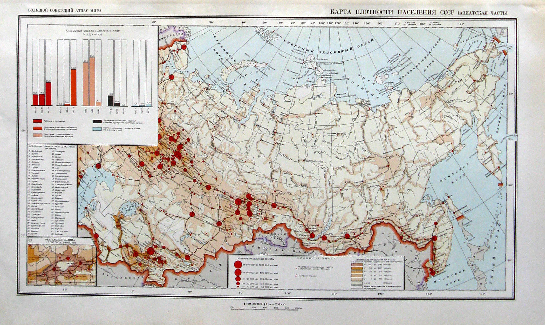
> I think Rusbernd could provide some maps or info about population density and industrial centers and such.
1, 2 - population density maps of 1940.
3 - industry at war. Pink marks on legend are related to post-1941, blue - pre-1941
4 - another evacuation map
Most of evacuated industry gone to Urals and Siberia, some to Central Asia. There were no mass population evacuation, except industry workers, so population density didn't change much. There were no big manpower reserves beyond Urals anyway (less than quarter of all USSR population).
It is hard to predict what regions were completely vital for USSR. Maybe loss of Moscow would be the point of no return, maybe not.